Spoleto Norcia: THE RAILROAD DISPOSED converted to bike path
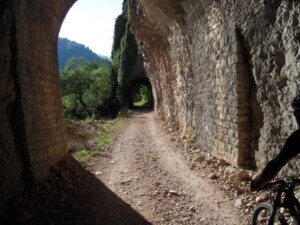
Now is reality !!!! After nearly 48 years since that July 31, 1968, the date of closure of the service, the route of the railway Spoleto Norcia has returned to be reused, obviously not to be walked on the tracks, but in a way more familiar to us: it has become a path pedestrian.
The old narrow-gauge railway, was opened in 1926 and was built by the same company that built and operates the railroad still Vigezzo Valley, another example of railway engineering Alpine, such as Spoleto, Norcia. According to what was once the director of the Institute of Art History in Florence between 1960 and 1990, John Koenig:
“Among the mountain railways Italian, some of which unfortunately dismantled the Railway Spoleto-Norcia has always been the unanimous judgment not only Italian, the maximum effort technique of the tracks; a kind of small Gottardo Umbro. Perhaps because one of the last railroads to be designed, it is also the most daring and difficult; so much so that today no one could come into his head to make a similar effort from scratch. But this example of railway technology is, in fact, as a monument to witness a particularly happy time in the way of building “works of art” stations. It therefore should be preserved as our artistic heritage and landscape together, precisely because the Italian Apennines landscape Centre is characterized by this constant relationship between nature and man. »
Along the way, relatively short 51 kilometers were built more than 19 tunnels, the longest of which, near Caprareccia almost 2 kilometers, and 24 bridges and viaducts, with various helical lengths, similar to those often found in the railways and alpine slopes of up to 45 per thousand, as the stretch between Spoleto and the valley of the Black River.
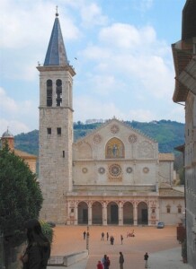
The path starts at the former station of Spoleto, a town famous for its Roman aqueduct, for its cathedral and the famous festival of the 2 worlds, converted to a museum of historic railway line, from here after a few rides in the city, there are places on the real grounds of the railway, which has a constant slope of 4% for the first 9 miles. A climb very quiet, no problems, easy to get too from the boys. On altronte this is one of the typical characteristics of the paths that use the former railway lines, fortunately for us the trains could not exceed the slope is too important!
After the first tunnel exit point here is the first spectacular: the viaduct Cortaccione, 120 meters long, 60 meters tall, the tallest of the route consists of 4 spans that connect the two sides of the valley and allows for a beautiful vantage point of the surrounding area. Immediately after another gallery, and the path continues with the always steady climb through the woods passing some bridges that allow spectacular views of the valley below.
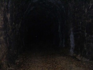
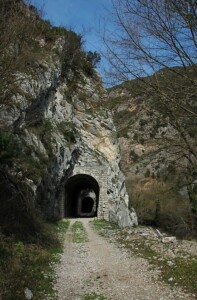
The climb continues up to the tunnel crossing the Caprareccia, 1936 meters long. Follow this road is a spectacular experience, we understand how they felt that the miners have excavated, the tunnel is dark, when you are inside you can not see it the input nor the output, just like when it was excavated.
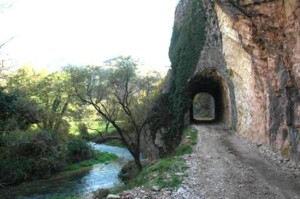
From here the route is downhill for about 7 km, always in the shadow of the trees, passing bridges and tunnels, with a continuous zigzag between one side and the other of the mountain until you get to San Anatolia di Narco, a small village Valdinarco. From here and remained for about 30 km the slope will be constant, but still less demanding of the first part of the route. The track touches Castel San Felice, with its Abbey of Saints Felice and Mauro, Vallo di Nera, a typical village built around the castle that stands on top of the hill, and still continues to touch the waters of the river Nera.
The path runs on the opposite side of the valley with respect to the road and always among the trees, giving you that feeling of tranquility that only a slow path as this can transmit. It continues overcoming Borgo Cerreto and Triponzio, and hence the state and the path, often run close up to misses, almost to see who came first in Norcia, in a series of bridges over the river Corno and tunnels up to Serravalle, where each the two tracks resumes its path running for the last five kilometers parallel but distant from each other …
Once Norcia route was rightly considered a bold path for a railroad gem. But beyond the aspects ingegneresti this track has allowed us to visit a small corner of one of the greenest regions of Italy, full of history, in every limb, between towns perched on the mountains, abazzie and monasteries hidden in the woods, until to reach the plateau of St. Scholastica where our arrival.
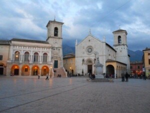
Norcia is justly famous throughout the world for its “charcuterie”, ie all the products that come packaged with the pig and the wild boar, first of all the ham of Norcia, the black truffle, for sheep, or for legumes that here have a special flavor, and then after a ride as quiet as the one just made, there can be no better thing than to find one of the many local restaurants, and get to know through the pleasures of the table, this piece of paradise … Have a nice meal!!! !
p.s. not exaggerated to eat, returning along the same road and then not be too heavy.


